Development of methods for analysis of satellite images for the description and monitoring of natural processes in the Arctic

Scientific analysis of satellite images and observations

Modelling of the natural processes and the assessment of recent climate change

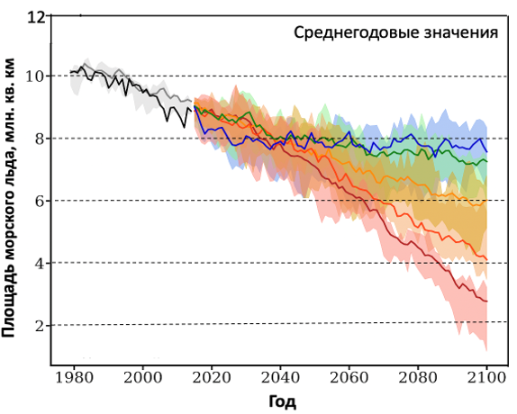
Studies of sea ice and hydrophysical processes in the ocean

Applied oceanography and hydrometeorology: Environmental Monitoring System in ice-covered seas – ice, navigation support, ecosystems, oceanographic fields, polar lows, anthropogenic pollution

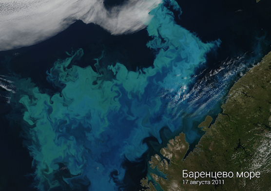
Assessment and real-time monitoring of primary production and harmful algae blooms in lakes, seas and ocean, sediment distribution

Data acquisition, validation of simulation results
Sea ice automatic classification using SAR data
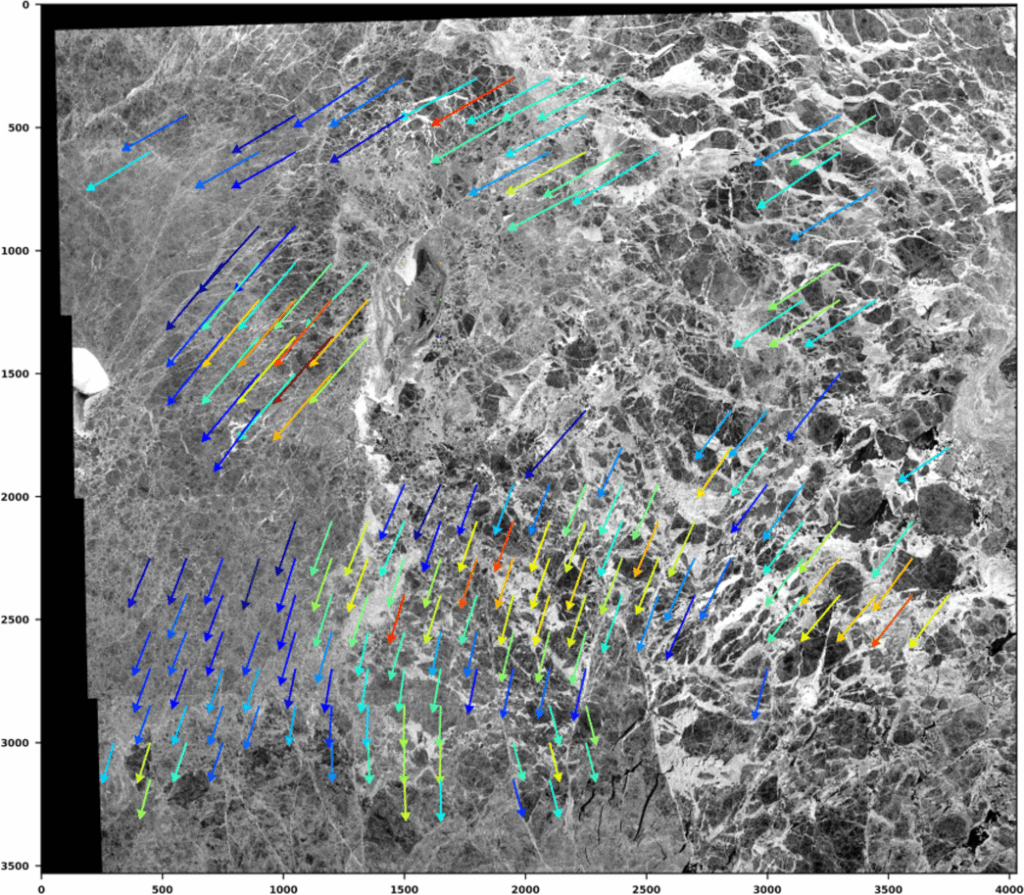
Calculation of ice drift fields using satellite data
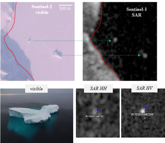
Detection and monitoring of icebergs, projection and iceberg drift modelling


Ocean and atmosphere variability of high northern latitudes
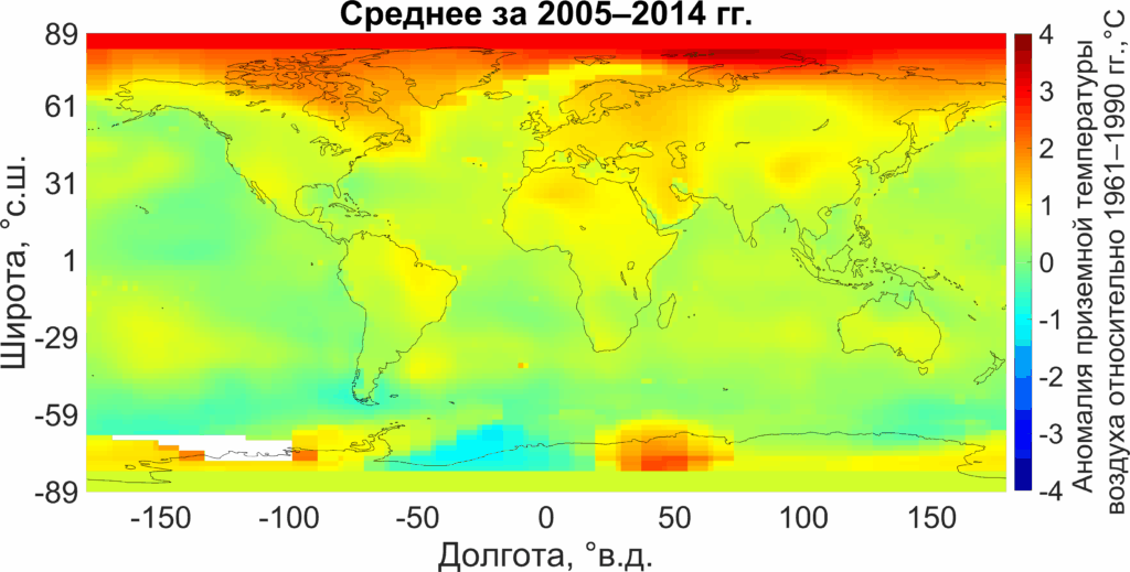
Arctic amplification
Monitoring and forecasting of polar lows


Assessment of the ecological status of water areas (microalgae biomass, chlorophyll, suspended matter, etc.)